I have a new essay in City Journal that looks at Daniel Parolek’s Missing Middle Housing — and the case for both land use and financing policies that encourage builders to develop more midsized housing options in growing regions. The bottom line: traditionally, homeowners could develop additional units as neighborhood markets signaled demand through rising prices. As this demand was met, prices would trend toward an equilibrium — with the smaller units being most affordable.
Today, land use policies often prevent or limit these kinds of resourceful adaptations by owners — and subject any proposed changes to the gauntlet of local politics, where those who oppose any change often have a deep advantage. (Note how even the legal concept of ‘spot zoning’ militates against boards allowing incremental change, by deeming it facially illegitimate to change the rules for a single property outside the comprehensive planning process — even though such gradual adaptation in response to opportunities is how cities have historically grown.) One result, in the aggregate, has been a widespread shortage of affordable housing in growing regions.
Victorian-era rowhouses in New York’s Hudson Valley. Such construction traditionally provided an attractive segment of housing on small amounts of land. Photo: Theo Mackey Pollack.
The historic center of Tunis, as it appeared circa 1890. Source: Wikimedia Commons.
In the spring, I mentioned the work of Besim Hakim in an article at TAC about the traditional urbanism of the Mediterranean. Since then, I’ve had the good fortune to speak with Hakim (an incredibly kind and knowledgeable man); and also to read an earlier book of his, Arabic-Islamic Cities, in which he laid out his findings about traditional urban planning rules from the Islamic world. Here’s an excerpt from a review that I offered:
Excellent research and analysis. The author provides an in-depth study of the traditional rules and urban forms that shaped urban growth in the Islamic west (i.e., the Maghreb and Andalucía). Much of what he uncovers and writes about (including treatises by medieval jurists and observations of repeating patterns) adds significant depth to the conventional present-day, Western understanding of urban genesis.
The author’s primary case study is the old city of Tunis, which sits near the Mediterranean coast, close to the site of ancient Carthage. For more than a thousand years, Tunis grew according to a bundle of simple and flexible traditions. The author’s maps and diagrams illuminate these visually — and an accompanying narrative provides context and explanation. Topics range from the small (e.g., party walls, windows, houses, and cul-de-sacs) to the large (e.g., marketplaces, religious sites, defensive walls, and citywide patterns).
Many unique elements of Islamic and Mediterranean urbanism (e.g., covered markets, privacy measures shaped by religious traditions, and arcades over public streets) are treated carefully. Citations to the Quran and Hadith illuminate the cultural aspects of the Islamic components (or justifications) of the urban form. (A later book by the same author, Mediterranean Urbanism, traces a variety of similar urban phenomena from ancient times down through the Byzantine Empire to the building practices of Christian Europe.)
This is a valuable piece of scholarship that is focused on the traditional, sustainable building patterns of vernacular urbanism. Urban planners, lawyers, builders, and architects should read this (as well as Hakim’s Mediterranean Urbanism) for a deeper understanding of how towns and cities were traditionally formed. Highly recommended for anyone with an interest in urbanism, history, property law, or the dynamic between customs and the built environment.
I’m gradually making progress on an essay that I think will be of interest to general readers, that will examine some of this history, including what Hakim has uncovered. In the meantime, I highly recommend Hakim’s work to readers with an interest in the nuts and bolts of more traditional approaches to urban growth. His writing is incredibly interesting, well researched and documented, and relevant to the challenges towns and cities face today.
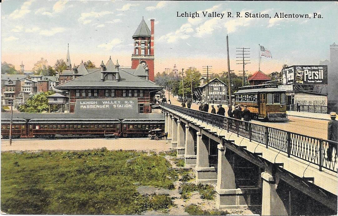
Addison del Mastro has a thoughtful essay at Real Clear Policy about the changing real estate landscape in eastern Pennsylvania’s Lehigh Valley, a region that includes the older cities of Allentown, Bethlehem, and Easton. His piece is focused on the disappearance of affordable housing across the region as it becomes more closely entwined with the economy of New York City. Long-term residents are being priced out; new housing is coming online very slowly, due to the usual morass of American regulatory barriers; and what’s being built largely caters to those with money.
I find it very sad to see this phenomena marching deeper into the American continent. Clearly, we have learned little from the past 40 years, because this is a repetition of a pattern that was seen in the working-class parts of New Jersey and the outer boroughs of New York City a generation ago. A community cannot absorb a great influx of new people under restrictive land use regulations without squeezing out long-term residents. At first, the results seem positive: reinvestment in vacant properties and improving tax rolls. But once any slack in the market is soaked up, this is what happens. And while some owners will cash out on rising property values, local renters and young people will be the ones who get the business end of the deal.
On a brighter note, it’s true what Addison writes about Pennsylvania’s small-town urbanism, here and on his Substack. My firm recently proposed on some planning work in the anthracite coal region, where zoning has never been enacted by some towns. The urban patterns are very traditional. Towns may be five blocks long, but for those five blocks it feels as though you’re in an old city. It’s nice.
Traditional city rooflines on Arthur Avenue in the Bronx. Photo: Theo Mackey Pollack
The Wall Street Journalreports today that the United States needs 5.5 million new housing units. That’s a serious backlog. As a nation, we are not building homes quickly enough to keep up with population growth. This is the story behind the soaring prices we hear about in the news. Digging a bit deeper, it could also be a key factor in falling birthrates and adults who continue to live in their parents’ home. So, how do we get serious about building the homes people need? Shouldn’t the market be driving toward an equilibrium?
The market is hot (again), but the shortage is chronic. Part of the problem is undoubtedly zoning, especially in the regions with the greatest demand. In New Jersey, the Mount Laurel doctrine has been a valuable tool since the 1970s, when it established the basic legal principle that zoning is a state action that may not be used to exclude entire classes of state residents from particular communities; to do so is inconsistent with the 1947 New Jersey Constitution. (I simplify, but not too much.) The New Jersey Fair Housing Act, which the state legislature enacted in 1985 to follow the Mount Laurel cases, has helped produce a significant number of regulated affordable units, over the years. Yet Mount Laurel, though based on an exemplary principle, has invited constant political resistance. Its implementation has been obnoxiously complicated. Worse, it does little tangible good for New Jersey residents who don’t fall into the income band for affordable housing — or even many who do, because the demand always outstrips the availability of units.
Yet today, more than four decades after Mount Laurel crystallized the concept of exclusionary zoning, the impacts of a chronic housing shortage reach much further up New Jersey’s socioeconomic hierarchy than they did in 1974, when the first case was argued before the New Jersey Supreme Court. That is, there remains a severe shortage of decent, affordable housing units for poor and working-class people. But there is also a dearth of homes for sale (or rent) at higher price points, in many communities — a bottleneck similar to ones that have formed, to greater or lesser degrees, in other high-cost metropolitan regions throughout the world. Not surprisingly, out-migration continues apace. Yet immigration keeps the overall population going up. Those who stay pay more for less.
So how can this unmet housing need be met? And should housing policy necessarily be bureaucratized, or could it be pursued more effectively by unlocking the private production of more market-built, non-income-regulated units? One concept that the Mount Laurel formulas acknowledge is filtering. That is, older units (often well built!) will become more affordable, through market forces, when newer units are produced quickly enough to soak up a lot of the high-end demand. This is how, for example, poor and working-class people inherited the incredible (if neglected) Art Deco apartments of the Grand Concourse (for a time — they are getting expensive again!).
I believe the next frontier will be a process of artfully (at best) customizing and improving zoning laws. Done wisely, this will foster the construction of market-rate homes that complement our existing neighborhoods while improving land values and strengthening public finances.
An exuberant house in New York City’s Douglaston neighborhood. Photo: Theo Mackey Pollack
In an interview this week with Yahoo! Finance, Yale economist Robert Shiller weighed in on the state of the US housing market, which has surged during Covid-time. Longtime readers may know that I’ve long found Shiller’s market analysis intriguing — especially because he has such a keen interest in the human customs and psychology that shape our markets, and those factors tend to be hard to quantify (which undermines the supposedly mathematical nature of trade). In this clip, Shiller talks a bit about some of the psychological factors that may be at work in the Covid-time housing boom — and where things may be going next. His bottom line? “Home prices are likely to be high for another year or two, and they will bring in a supply response and come back down. Not overnight, but enough to cause some pain.”
For context, this month, the S&P CoreLogic Case-Shiller New York Home Price NSA Index showed a housing price change in the New York City region of 12.3 percent (+) in the 12 months ending March 2021 — almost precisely corresponding to the year that followed the March 2020 Covid shut-down in New York City and its suburbs.
A 1939 “residential security” map of Essex County, New Jersey. The eastern half largely comprises of Newark and the Oranges.
Mapping Inequality provides a fascinating time-sink: a zoomable map of the United States overlaid with New-Deal era local maps of most major cities, depicting what we today would call redlining. Typically, this term brings to mind the practice of dicing up neighborhoods and excluding African-American areas from mortgage eligibility. The heyday of this coincided with the heyday of post-war, first-time suburban home ownership in the United States — and that timing has been identified as a key source of persisting family wealth disparities between Black and White Americans. (The achievements of the Civil Rights era, and further legislation aimed at dismantling redlining, did not come about until the tail-end of the post-war boom — starting in the mid-1960’s — by which point many of the regional ethno-geographic patterns had already been established, and property values had begun to increase significantly.)
The map above depicts Essex County, New Jersey, where I live, and which has the same boundaries today as it had in 1939. Newark, the county seat and largest city, is roughly on the right; many of its inner-ring/streetcar suburbs are roughly in the center; low-density townships (then still partly rural outside Millburn and Caldwell — now mainly affluent suburbs) are on the left. As you might guess, there is a hierarchy of colors: areas mapped in green were considered prime investments, followed by blue (still desirable); yellow (declining); and red (dangerous). Zooming in on the neighborhoods of Essex County reveals that many of the patterns of neighborhood gradation that were adjudged by appraisers for the federal Home Owners’ Loan Corporation (HOLC) in 1939 overlap with the characteristics of the same neighborhoods today. That is to say, if the green-red palette were to be roughly translated as neighborhoods that are predominantly wealthy, middle-class, working-class, or poor, its assessments would still align with many districts.
Many of these maps contain explanatory notes for each color-coded district, and many of these notes bear out a pervasive practice of correlating African-American neighborhoods with red districts. Several neighborhoods that today are mainly Black were already Black neighborhoods by 1939, and the matter-of-fact prejudice expressed in otherwise mundane business notes leaves no doubt that mortgage lending — at least during the late Depression — was based on an overtly discriminatory calculus.
Also remarkable, given the conventional understanding about what redlining was, is how clear it is that these maps were also used to justify discrimination against other groups — including many of European origin. Thus, Italian and Jewish enclaves were singled out for negative treatment. Many poor and working-class neighborhoods with mostly European residents were classified red, just as Black neighborhoods were. In both Newark, N.J. and New York City (maps are also posted for each of the five NYC boroughs) many of the red districts described as “slums” encompassed residents of all ethnic and racial backgrounds. And working-class neighborhoods that avoided being fatally redlined were typically shaded yellow — branding their properties as the second least desirable class of collateral.
The impact of these maps is not clear. The federal HOLC of 1939 was not a formal precursor to the private banks that — with government backing and subsidies — financed the massive suburban development wave that took place after World War II. A study of early HOLC lending in the Philadelphia region found that interest rates, but not lending decisions per se, were influenced by the maps’ color-coding; and that private lenders had other sources of comparable information about granular urban economic and demographic trends. Sources like fire insurance maps, meanwhile, would have allowed lenders to analyze the building stock in any slice of any city.
Another study found that the HOLC had hired private-sector appraisers to complete the evaluations and explanatory notes for the residential security maps, suggesting the conclusions they contain represent prevailing assumptions in the real estate industry of that time. Regardless of their direct impacts, the patterns in these maps bear an uncanny resemblance to the enduring patterns of racially and economically segregated housing that solidified in post-war metropolitan America. How these maps and the lending policies that they shaped might align with early land-use zoning maps developed around the same time is another topic for exploration.
It is worth noting that private covenants were still common for controlling land use in the early days of zoning, as they represented one of the few traditional legal devices for doing so prior to the rise of public land use law — and many of these had discriminatory provisions of their own.
The Times has another article jumping on the bandwagon about the supposed ongoing urban exodus — with a twist. This one reports anecdotal evidence that apartments in suburban towns are seeing a surge in popularity among fleeing urbanites. (Sorry for the paywall. If you’re not a NYT subscriber, you can usually still read a few articles for free if you log in with a Google account.)
I’m going to take a wait-and-see approach to this trend. I have long believed that the New York City region, and similar metropolitan regions with high housing costs, ultimately need to expand their geographic footprint of multifamily housing beyond its current locations to accommodate long-term population growth. I still believe that. But what we are seeing in 2020 is a separate and discrete trend, driven by people’s more immediate desire to get out of the city, and to have more room, as work and home suddenly compete for the same space.
It’s not clear yet how these trends are going to intersect with the housing markets in the suburbs. If working from home (WFH) turns into a permanent phenomenon that outlasts the pandemic, then some of the built-up pressure may come off of competitive regions, including their inner-ring suburbs, as people are free to go further afield and seek permanently larger spaces. In such a scenario, there may be additional suburban growth at the metropolitan fringe, but less demand for new apartments nearer to the core. On the other hand, if most people return to their daily commute (or something close to it), then the suburbs may find themselves needing to absorb more commuters — as trends indicated before 2020 — and doing so in the form of more apartments.
It’s an interesting question — and one, I think, that is still very open. If I had to bet, I would predict a little bit of both, especially in places like Northern and Central New Jersey: a continued need for growth in demand for (1) compact, commutable units and (2) larger, WFH-friendly properties at the fringe, and beyond. In both scenarios, good planning will be a necessity to ensure that new growth takes the form of attractive and sustainable neighborhoods.
New apartments take advantage of commuter rail service in suburban South Orange, N.J.
My latest article at TAC‘s New Urbs is a response to the recent op-ed in the Wall Street Journal by Donald Trump and Ben Carson. Contrary to the president’s rhetoric, allowing people to build neighborhoods that evolve in response to land markets is an old common-law tradition — and one that has been increasingly distorted by local governments over the last century, under an ever-more-restrictive morass of zoning requirements.
I argue that measures that would restore even some space for neighborhoods to grow organically, in response to demand, ought to be embraced by Americans across the political spectrum. New laws in California, Oregon, and Minneapolis are good first steps. And proposals to condition certain streams of federal infrastructure funding on having non-exclusionary local land-use laws in the communities that benefit from such taxpayer investments should not be dismissed out of hand.
This piece is something of a spinoff from the original research that I did several years back, and reported on this blog, about the last few Queen Anne-style Victorian houses along Woodycrest Avenue in the neighborhood known as High Bridge. Sadly, the city’s Landmarks Preservation Commission declined a proposal to preserve these last few detached gingerbread houses on the NYC street grid (that is, the one begins in Manhattan and continues north to the Westchester County line), and many have now fallen to the wrecking ball.
Several people have expressed interest in this topic. In addition to the ones on Woodycrest Avenue, I tried to document the handful of other remaining houses like these that are on the Commissioner’s Plan-Risse Plan streets of the West Bronx. I documented the research several years back, and most of it can be found here: https://www.legaltowns.com/category/the-bronx/
Here’s some good news: in New Jersey, the government can’t take your land for a public purpose unless it has, actually, um, specified a public purpose. That’s good. But here’s the bad news: in Atlantic City, a state agency called the Casino Reinvestment Development Authority has spent the past five years trying to do precisely that, to a local couple. Specifically, the agency tried to leverage the state’s power of eminent domain to take away Charles and Linda Birnbaum’s three-story building and “bank” it for an unspecified future use.
Birnbaum retained the right to keep the home his parents, who were Holocaust survivors, bought in 1969, because the state’s Casino Reinvestment Development Authority could not provide assurance that its plans for the property and surrounding area “would proceed in the reasonably foreseeable future,” the court ruled…. Birnbaum’s mother, Dora, lived in the house on Oriental Avenue until 1998, when she was killed during a home invasion. Birnbaum, who lives in Hammonton with his wife, rents out the upper floors and uses the first floor for his piano-tuning business.
Your tax dollars at work, New Jersey. It’s good that the court said no. But maybe this case is a signal that it’s time for the state to stop acting as a legal henchman for casino developers. Casino gambling has failed to bring back Atlantic City, after more than four decades. It has, however, destroyed much of what once remained of the traditional seaside urbanism of America’s prime Victorian-era beach resort. And it has resulted in perverse scenarios like the one at the center of this lawsuit.